Software Company Introduction
ClearEdge3D, a Topcon company, is a leading provider of automated Scan-to-BIM and construction verification software for the architecture, engineering, and construction industries. Trusted by more than 1,000 firms worldwide, the company applies advanced computer vision, automated feature extraction, and point-cloud processing technologies to transform reality-capture data into accurate, actionable digital models. Its flagship solutions, including EdgeWise and Verity, streamline as-built modeling and QA/QC workflows, reduce manual effort, improve model accuracy, and help project teams deliver reliable results more efficiently.

Opening Scene
Before BIM modeling begins, one key question matters most: Does the collected data accurately mirror the real site?
Maintenance through years can reshape industrial pipeline into a challenging environment to capture using conventional methods. However, high-accuracy 3D mobile laser scanning bridges this gap by transforming complex site conditions into reliable BIM-ready data.
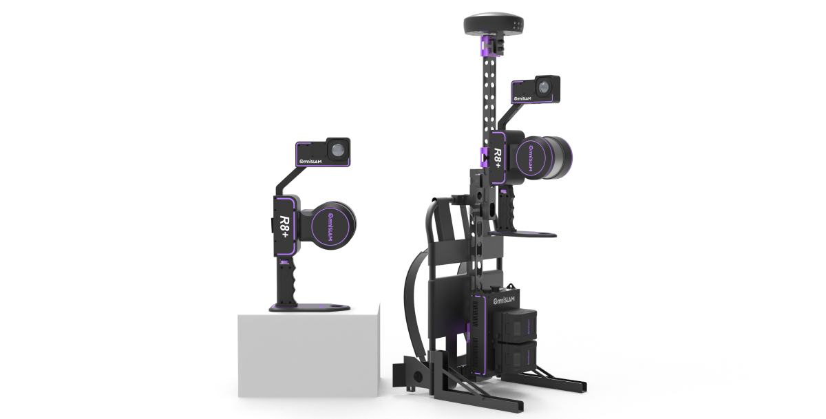
That was the idea behind this partnership between OmniSLAM and ClearEdge3D. OmniSLAM captured a 4,800 m² industrial pipe network in China using the R8+ backpack mobile mapping system. ClearEdge3D then used the resulting point cloud in EdgeWise Pro to build a reliable BIM model directly from the measured site condition
The mission was clear: Capturing accurate site data ready for downstream modeling workflows.
When Pipe Geometry Gets Difficult
Capturing industrial pipe environments demands more than capturing what is visible. Such sites are packed with overlapping systems, making capturing small and partially hidden objects hard while maintaining the level of accuracy needed for BIM modeling. The central problem became: How can such complexity be captured efficiently while still producing complete, accurate, and BIM-ready data?
This raised a critical challenge:
How can accurate, BIM-ready data be delivered in such a complex environment?
Building the digital Foundation
OmniSLAM R8+: Mobile Reality Capture Workflow
For dense industrial pipe projects, reliable BIM outputs are shaped at the scanning stage, where every missed detail can influence alignment, system connections and documentation quality.
Engineered for versatility, the OmniSLAM R8+ can be used in a handheld, backpack, and vehicle-mounted operation without compromising data quality. It generates millimeter-level point clouds with a 2 mm thickness, delivering reliable geometric foundation that BIM workflows rely on.
The OmniSLAM R8+ mobile SLAM laser scanner was operated along a continuous path through the site covering approximately 4,800 m². The full area was scanned in only 20 minutes, capturing pipelines, supports, and surrounding infrastructure, giving the modeling team complete coverage of the existing network. GNSS signals were available on site and assisted positioning.
While working through the facility, the operator continuously visualized the point cloud in real time using the OmniSLAM Capturer. This live visualization made it easy to confirm scan completeness in real time, creating a smoother transition to data processing, while maintaining the level of coverage and detail required for BIM modeling.
OmniSLAM Mapper: Data Processing
Field capture alone is not the handoff. Before the data can move into a BIM workflow, it needs to be transformed into a reliable engineering dataset.
Using OmniSLAM Mapper, the captured survey was processed entirely on-premises. Localization and point cloud generation were completed in less than two hours on the user's workstation, avoiding cloud based processing while keeping project data under the team's control.
The final deliverable reached a data size of 8.61 GB and was exported in LAS format ready for BIM workflow. Reaching a high density of 250,000 points/m², the dataset provided detailed geometric information for identifying pipe routes, supports, valves, and surrounding structures, and achieved absolute accuracy less than 3 cm.
That's the kind of point cloud BIM teams want to receive.
ClearEdge3D: Modeling Against Measured Geometry
Automated Pipe Extraction
Capturing the site is only half the workflow. Once the point cloud is ready, its real value depends on how efficiently it can be transformed into an engineering-ready BIM model. That's where ClearEdge3D came into the workflow. Specializing in Scan-to-BIM solutions, the company enables engineering to turn dense point cloud into an engineering-ready BIM deliverables using EdgeWise Pro, its flagship modeling platform.
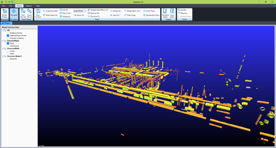
Working from the OmniSLAM point cloud, ClearEdge3D produced a complete piping and structural as-built in roughly 12 hours, delivering the final model as native Revit families ready for downstream engineering workflows.
EdgeWise Pro QA Against OmniSLAM Point Cloud
Before the model moved forward, EdgeWise Pro’s QA tools checked each pipe against the OmniSLAM point cloud.
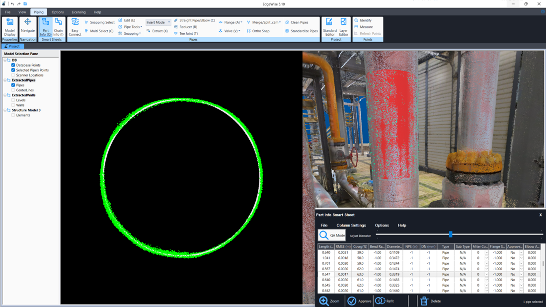
Here, the strength of the original survey becomes visible. With a clean and consistent point cloud, the team focused on the extracted pipes, not question the point cloud.
Modeling the Fittings

With the OmniSLAM point cloud as the geometric reference, EdgeWise Pro's purpose-built fitting tools added 403 elbows, 71 tees, 229 couplings, and one reducer, bringing the model to more than 1,600 piping elements while reducing manual modeling in Revit.
Structural Extraction
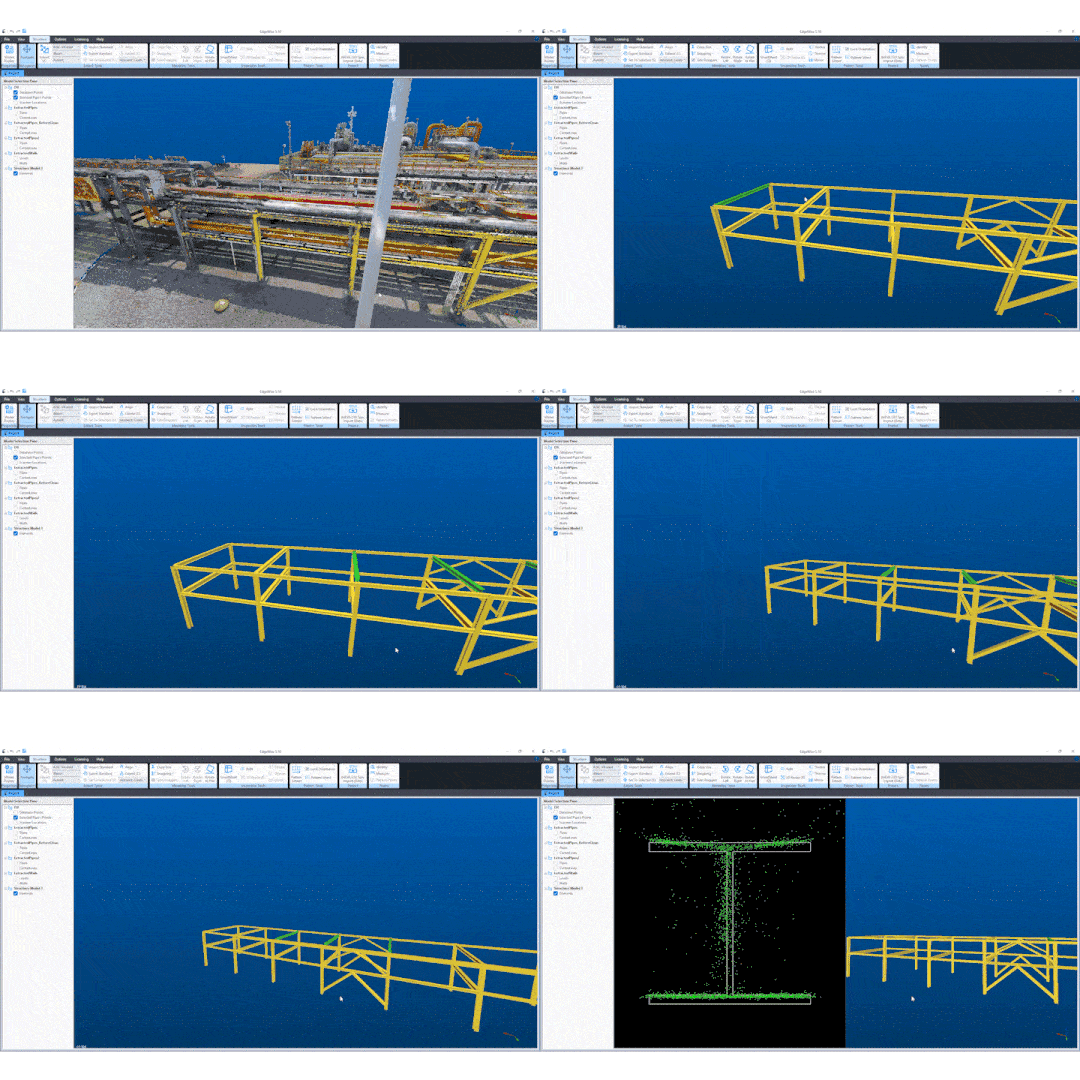
Repeated steel members often take the most time to model manually. EdgeWise Pro's Pattern Extract tool reduces that effort by identifying similar steel elements throughout the point cloud and fitting them automatically, instead of requiring each one to be modeled one by one.
Native Revit-Ready Model
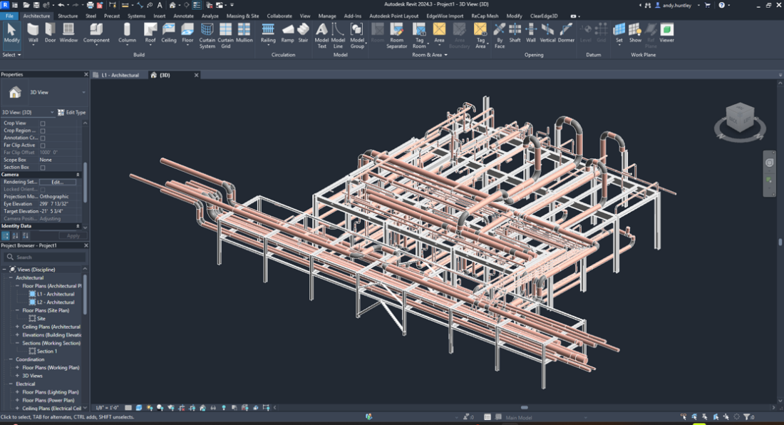
Built from OmniSLAM's high-density reality capture data, the completed model was exported from EdgeWise Pro to Autodesk Revit as native Revit families, ready for coordination, documentation, and downstream BIM workflows.
The Outcome: A Complete Digital Representation
The numbers tell the story: 20 minutes on site, followed by a complete BIM-ready model of the entire pipe network.
By combining their expertise, OmniSLAM mobile scanning and ClearEdge3D EdgeWise Pro delivered:
• 4,800 m² industrial pipe network captured in 20 minutes with the OmniSLAM R8+ backpack scanner.
• 8.61 GB LAS point cloud delivered with 250,000 points/m² density and <3 cm absolute accuracy.
• ClearEdge3D EdgeWise Pro converted captured geometry into a BIM model with 1,600+ piping elements and 140+ structural elements.
• Native Revit-ready deliverable created from measured site conditions.
Connecting Capture and Modeling
OmniSLAM and ClearEdge3D bring together accurate mobile scanning and advanced BIM modeling to transform complex site conditions into dependable digital documentation.
"High-quality scan data is rocket fuel for automated modeling. When the point cloud is this clean, EdgeWise Pro can extract, fit, and verify with far less manual intervention. The OmniSLAM R8+ delivers that quality. We're excited about what this partnership unlocks for teams looking to expedite scan-to-BIM without sacrificing quality." - ClearEdge3D
See how OmniSLAM reality capture data moves from the field into a complete BIM workflow.


Wondering how EdgeWise Pro transforms accurate point-cloud data into reliable, BIM-ready models?
Discover more about EdgeWise ProCONTACT US
support@omni-slam.com
Contact with your product representative.