T8 | World-Realistic Color, mm - level Precision

Vehicle-Mounted Solution

Powered by next-generation intelligent mobile SLAM technology,
a lean, optimized, and compact design, and flexible deployment,
the T8 redefines mobile mapping efficiency.

Advanced Intelligent
Mobile SLAM Technology

The T8 breaks away from the conventional GNSS/INS integrated navigation paradigm. Powered by OmniSLAM's next-generation mobile SLAM technology, it enables real-time positioning and mapping without GNSS. Even in satellite-denied environments such as dense urban areas, tunnels, or under elevated highways, it delivers stable operation and high-precision colored point clouds while reducing system complexity and deployment costs.

Fixed Triple LiDAR

The T8 features a uniquely engineered  Tri-LiDAR array with a complementary configuration, where three LiDAR sensors operate together for cross-coverage. Through multi-beam intersection and real-time data fusion, it achieves blind-spot-free panoramic scanning. Even in complex environments, the T8 captures dense, high-quality point clouds with fine detail, delivering continuous data at any speed.

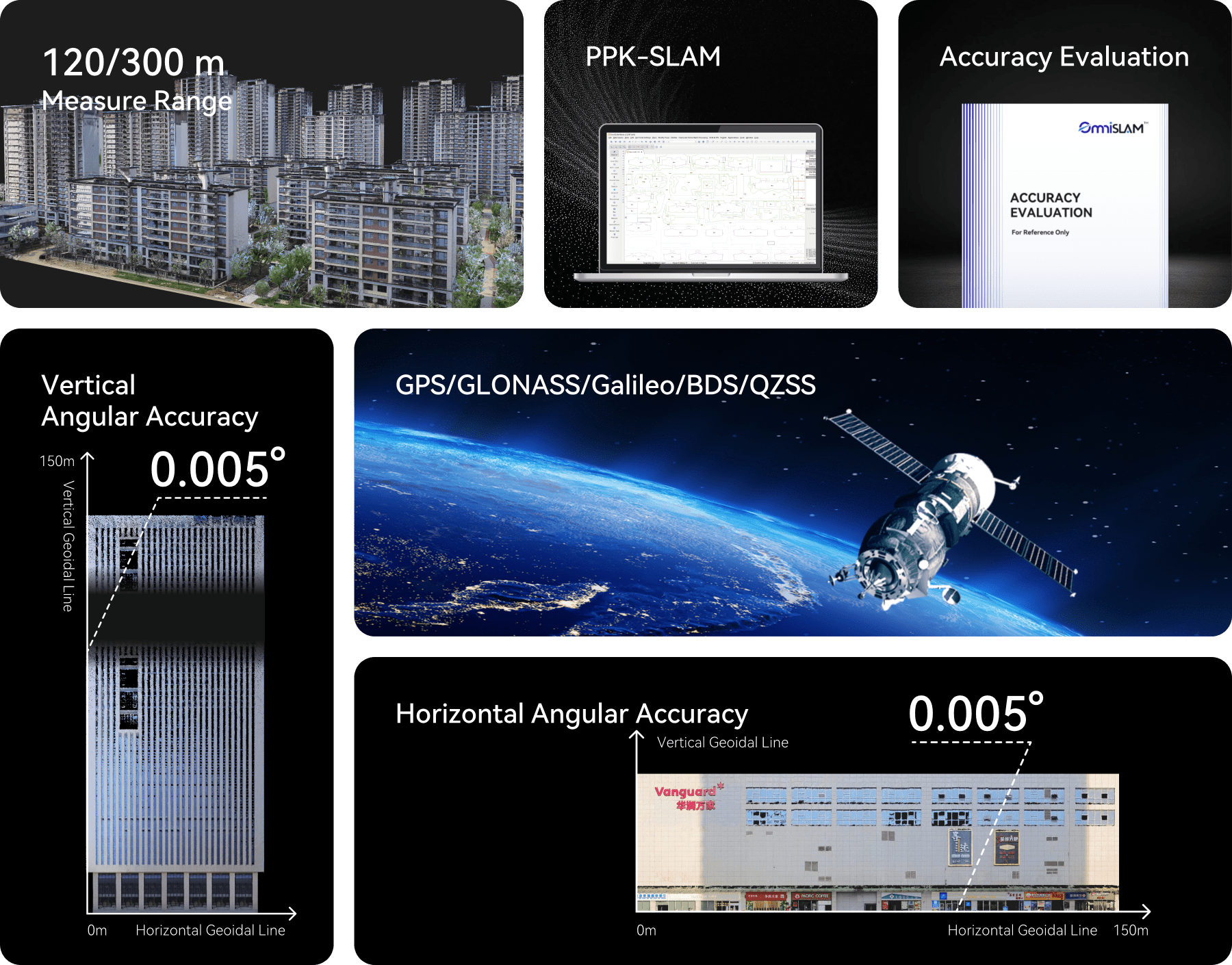
Absolute Accuracy Level (cm)

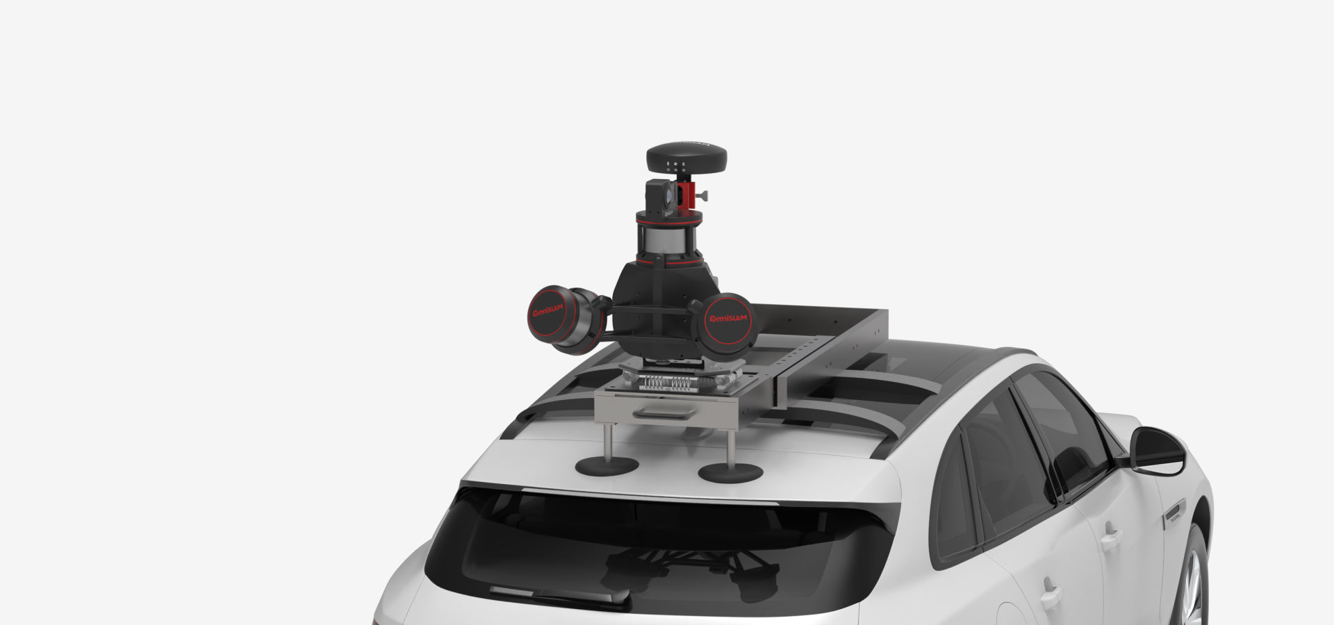
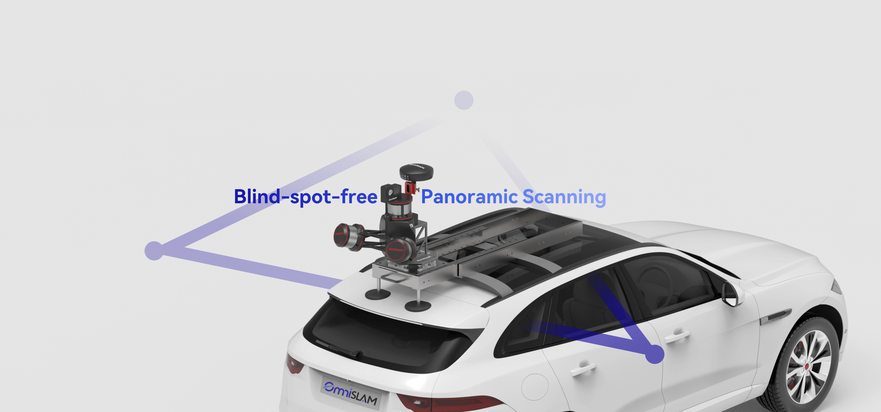
In so-called "signal black holes", such as elevated roads, complex interchanges and tunnels where RTK signals often fail, loss of lock and trajectory drift are no longer concerns.Powered by OmniSLAM's next-generation mobile SLAM technology, the T8 maintains stable positioning and high-precision point clouds even in fully GNSS-denied environments.

No Clumsy Figure-8 Maneuver
Just Power On and Scan

The T8 eliminates the need for figure-8 calibration drive routines, with true instant-on capability allowing data acquisition to start immediately. By streamlining the workflow from power-on to production, it maximizes field efficiency and redefines the performance of high efficient vehicle-mounted 3D mapping systems.

High-Precision Scanning Across All Complex Terrains

Tunnel
Elevated Road
Interchange
Dense Urban Area

The T8 is engineered to excel in a wide range of challenging geospatial environments, including tunnels, elevated roads, interchanges and dense urban areas.Where conventional systems struggle with signal loss and trajectory drift, it maintains stable positioning and continuous acquisition, delivering high-density, high-precision point clouds even in GNSS-denied conditions.

60km/h Highspeed Scanning

The T8 is purpose-built for large-scale, long-distance highway data acquisition, maintaining stable, high-precision point clouds even at speeds up to 60 km/h. Advanced motion compensation and SLAM optimization reduce distortion, ensuring engineering-grade data in density, accuracy, and completeness without sacrificing efficiency.

Unaffected by
Frequent Starts / Reversing

Powered by its proprietary mobile SLAM technology, the T8 ensures accurate point cloud registration even during frequent stops, sharp turns, and reversing maneuvers.In complex urban traffic conditions, it consistently delivers high-precision, high-completeness point clouds, eliminating the data instability traditionally associated with stop-and-go vehicle-mounted scanning.

Start-Stop
Reversing

Dense, Uniform and Sharp

The point clouds generated by the T8 feature a uniformly distributed, high-density structure with no sparsity and sharply defined edges. From detailed road surfaces to building facades, it captures fine features with precision, consistently delivering high-quality, geometrically accurate, and richly detailed data.

Pixel-Perfect Alignment
Flawless Color
& Intensity Mapping

The T8 leverages proprietary technology to produce point clouds with highly accurate color reproduction perfectly aligned with intensity data.

RGBA Intensity

2 mm
Point Cloud Thickness

The OmniSLAM T8 delivers an ultra-thin point cloud with a thickness of 2 mm. Even under high-speed motion, it accurately preserves object edges and subtle features.

Flexible Power Solutions

The OmniSLAM T8 offers three versatile power options - battery, car lighter and outdoor power supply. This setup overcomes the challenge of limited electricity and enables uninterrupted, efficient data capture in remote areas, highways, and large-scale outdoor survey projects, supporting long-duration mobile mapping missions.

T8

32×3

Laser Channels

120 m

Measure Range

1,920,000

Points per Second

T8-300

32×3

Laser Channels

300 m

Measure Range

1,920,000

Points per Second